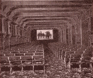
The London’s Silent Cinemas Map allows you to see where the city’s earliest cinemas were located. It contains information about over 700 cinemas that opened in London and its suburbs from the first permanent film venues around 1906 to the end of the silent film era around 1930.
Click the ‘Explore’ box to launch the map.
To read more about the geographical area covered by the map, click here.
To find out more about the information used to create the map, visit the Sources page.
Using the map
The London’s Silent Cinemas Map shows the location of early cinemas in London on a modern map of the city. You can drag the map to change its position, and zoom in and out using the ‘+’ and ‘-’ buttons in the top-right corner. Each dot on the map represents a cinema. Clicking on a dot reveals details about the venue, including its name, address, number of seats and the years it operated. You can also find details of the venue’s first known owners and managers, and read notes about the building’s history. Opening the full record tells you more information, including geographic coordinates (as accurate as possible), and where the evidence about this venue came from. Variety theatres and other early venues for film exhibition are not included on the map, unless they later converted to full-time use as cinemas.
Views
The standard view of the London’s Silent Cinemas Map shows every cinema that opened in London between 1906 and 1930. To change this view, select one of the options from the ‘Legends’ drop-down menu in the top-left corner. Selecting the ‘Year by year’ view allows you to explore how the map of London’s cinemas changed over time. Tick the box next to a date (from 1906 to 1930) to see only the cinemas that are known to have been operating in that year. Selecting the ‘Seating capacity’ view allows you to explore cinemas by size. Tick the box next to a seating capacity range (from less than 200 to greater than 2,000) to see only the cinemas known to have contained that many seats when the venue first opened. To return to the standard view, select ‘Show all cinemas’.
Recommended browser
Please note that the map may not load properly in Internet Explorer. If you have trouble viewing the map, try opening it in either the Firefox or Chrome browser. At present, the London’s Silent Cinemas Map will not work fully on devices that use a touch screen.
Acknowledgements
The London’s Silent Cinemas Map was created using DH Press, a digital humanities toolkit developed by the Digital Innovation Lab, University of North Carolina at Chapel Hill. Its base map is an OpenStreetMap view of London. All cinema locations are as accurate as possible, and the utmost care has been taken to credit sources of information properly. Corrections and additions are welcomed via the Contact page. Development of the map was greatly aided by the European Research Council-sponsored training course ‘GIS for the Digital Humanities’ at Lancaster University, and by a bursary from the UCL Train and Engage fund.
")